
Ahead lies our destination, Mt Dawson rising gently out of the surrounding plateau and visible through the trees as we stand atop some rocks. It is an hour or more walk away, weaving between numerous sandstone pagodas where they break out of the scrappy forest. And, I already know we are not going to make it. It is not that the forest is too thick or the afternoon too late. It is the fault of beauty.
Having left the car mid-morning, we have wandered up Little Capertee Creek, climbed the steep slope to the top of the scarp and onto the Capertee-Wolgan Divide, a narrow run of range separating two valleys. We have continued across the narrow divide to check out the view from the other side. And, this is where the plan goes awry.
 |
| Mt Canobla |
 |
| Pantoneys Crown in the distance |
 |
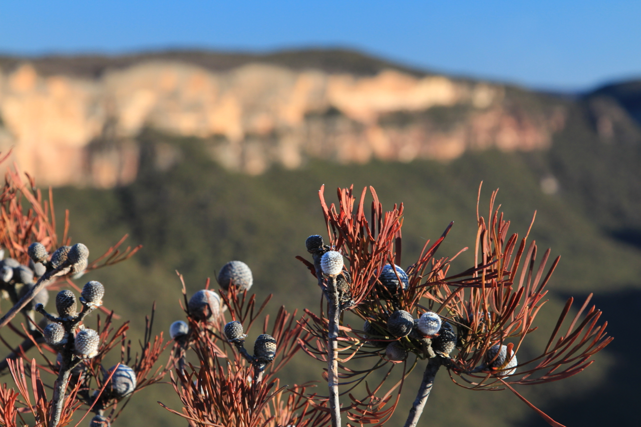
| Little Caperteee Creek valley |
We will not make Mt Dawson because there is simply too much absorbing, breathtaking, wonderful beauty along the way – intricately weathered plumes of stone, enticing narrow slots between the rocks, plunging sheer cliffs. We find Gindantherie Pinnacle just beneath us, views of the vast Capertee Valley spread out before us and out there, towering above farmland and forest is the magnificent bulk of Pantoneys Crown washed with light and shadow. We cannot rush past this.
We spend an hour, without our packs, exploring the escarpment edge before finally deciding to go no further. It takes another hour to make the difficult decision as to which westerly point will be the best place to camp, giving the greatest panoramic vistas for sunset and sunrise.


The Capertee-Wolgan Divide runs in an east-west direction. We started in the Wolgan Valley on the south side of the divide, at Newnes Campground. Now we are camped on the northern rim of the divide looking down into the Capertee Valley. On this side, we have lost sight of the Wolgan Valley (with its 'beautiful ass' mentioned in a previous blog post). But, the impressively wide Capertee Valley is equally beautiful. It is in fact, the world's second largest canyon in terms of width - 1km wider than the Grand Canyon - but, because of Australia's antiquity, not as deep.
It is certainly spectacular in its own ancient way and the afternoon quickly passes as we climb and explore the weird sand and iron-stone pagodas and ledges. Swallows dip and dive along the cliff lines. By evening, the air goes completely still. The sunset is quick. Three bright evening stars line up above the horizon with such precision it must be a celestial event of some ancient significance. There is a long, orange afterglow.
This area of the divide is known in bushwalking circles as the Red Rocks and there are rough pads leading west to Mt Dawson and east to Point Nicholson. They are quite well used and there is plenty of information on the interweb, especially on some of our favourite sites – Dave Noble's blog and the Sydney Bushwalkers and Fat Canyoners.
This area of the divide is known in bushwalking circles as the Red Rocks and there are rough pads leading west to Mt Dawson and east to Point Nicholson. They are quite well used and there is plenty of information on the interweb, especially on some of our favourite sites – Dave Noble's blog and the Sydney Bushwalkers and Fat Canyoners.
 |
| Gindantherie Pinnacle |
The Wolgan-Capertee Divide is in fact full of off-track fun, as is the entire Wollemi National Park in which it is found. Wollemi National Park contains the largest expanse of wilderness in NSW. Just 80km north-west of Sydney, the National Park covers more than 500,000 sq.km. This is where another Dave Noble (not the one mentioned above) discovered the Wollemi Pine in September 1994. An officer with the NSW National Parks & Wildlife Service, he was out exploring the deep, rugged canyons of the park. In one of these canyons he spotted some trees he didn’t quite recognise, Wollemia nobilis or the Wollemi pine. It was the discovery of an evolutionary line thought to be long extinct, made even more remarkable by the fact the pine is so tall and striking and growing just 150 km from Sydney, the largest city in Australia. The ‘Dinosaur tree’ or ‘living fossil’, the Wollemi pine is considered one of the greatest botanical discoveries of our time.
This from the Royal Botanic Garden Sydney: "To determine the age of the Wollemi Pine trees, a scientific team cut cross-sections from one of the fallen trunks (a large mature, 35-40 metre trunk) at the original site in Wollemi National Park, and sent them to the Australian National University Forestry Department for analysis. One of the most intriguing things that can’t be determined, due to coppicing (the unusual branching habit which leads to old Wollemi Pines having many separate trunks) is how old the original tree was before this particular trunk was produced. It may have been hundreds, or perhaps thousands of years since it was a seedling. By counting the growth rings from cross-sections of the trunk and combining this with carbon dating, the best estimate for this sample trunk is about 350 years old - research is being conducted on determining its age. This means that this trunk started growing around 1650!"
To put this discovery in perspective, this extract from the book Australia's Remarkable Trees: "When the long-lost Wollemi Pine was discovered in a remote canyon near Sydney in 1994, director of Sydney's Royal Botanic Gardens Professor Carrick Chambers announced that it was the 'equivalent of finding a small dinosaur alive on earth'. It was reported around the world. The species had been regenerating in this small area for millions of years, surviving raging bushfires and no less than seventeen ice ages."
As I sit looking across this magnificent, convoluted, labyrinthine landscape I think maybe there is something else to be discovered in the countless maze of peaks and rocky defiles, creeks and gullies that are there for the explorer.
As Dr Tim Entwisle, executive director of Sydney's Botanic Gardens Trust, wrote: "The Wollemi Pine is a unique reminder that the world is full of undiscovered wonders, that there is a lot more to know about our planet and a lot to protect."


The biggest issue, however, exploring our route along the Wolgan-Capertee Divide is water. The Red Rocks is just that, lots of rock. Walkers have to carry water and/or rely on rare and fairly unreliable rock pools on the high pagodas if wanting to stay longer than one night. These rock pools are usually shallow and dependent on recent rain. The creeks up high are usually dry.
While we carried enough water for our first day and night, our plan was to spend two nights up high. And it hadn't rained. Not recently. Probably not for months. Our search for water became a fun exploration of every pagoda we passed and then down into the upper reaches of Little Capertee Creek. It became a two hour return trip, sending us all the way back to the base of the rocky nose where we had filled up on day one and first climbed onto the scarp. The exploration, however, led us through pretty, fern-lined gullies, under towering sandstone walls and past old wombat burrows.
When we returned to the heights again, loaded with water once more, we turned right for our second night up on the divide. This time we struck off east towards Point Nicholson. We squeezed through a narrow gap in the rocks, walked cautiously along a crumbly, loose path in front of the cliffs, climbed a narrow gap between the rocks and passed a couple of well-used campsites one tucked in a shady, cold grotto amongst the sandstone.

Once up on Point Nicholson the views, again, were spectacular. This time Mt Canobla dominated the Capertee Valley below us and the view down into Canobla Creek, to our north-east was brilliant – pagodas towered out of the forest. Rugged, wild looking country stretched away northwards.
After setting up camp we spent the afternoon exploring to the point of exhaustion. By sunset, I simply had to lie down as the shadows lengthened and a myriad of small birds worked the treetops around us in the final throws of sunlight.
After setting up camp we spent the afternoon exploring to the point of exhaustion. By sunset, I simply had to lie down as the shadows lengthened and a myriad of small birds worked the treetops around us in the final throws of sunlight.
We woke the next morning to such a beautiful view. Mist lay in the Capertee Valley. The light was not great for photography but the sublime peace of waking in the bush made me happy to laze about on our balcony of rock out the front of the campsite. The birds were back and busy. Another day was underway.
Technically, we retraced our footsteps from Point Nicholson back to Newnes campground, but with slight variations made possible by knowing and seeing the route a second time. Before leaving Point Nicholson, however, we again climbed one of the nearby pagodas to take a final, longing look into the depths of the largest expanse of wilderness in the state – a perfect view for explorers and adventurers and lovers of distracting, faultless beauty.

All images and words on this site are copyright of Craig Fardell and Christina Armstrong. It is illegal to sell, copy, or distribute images and text without permission. We thank you for your help in respecting the copyright of our work.
Great trip. Your comments on speed remind me of some people I went walking with, who very much wanted to go flat out and be finished by lunch. I like the scenery.
ReplyDeleteThe scenery is one of the main things we go for, afterall. Thanks for the comment, Ken.
DeleteGreat description! I love Wollemi National Park too.
ReplyDelete