Pages

Tuesday 24 December 2013

Bangalore Creek - the warehouse of waterfalls - Bindarri National Park

I'm on, screw gate nipped up: it's still an uneasy walk backwards. Dropping into the vertical world the walls of rock are black and slick. Trust is a rope. I'm being peppered by water droplets and lower my head so I can see and breath.  I hit rock bottom and bellow...CLEAR.


Saturday 14 December 2013

Rafting Ramornie to Jackadgery - Nymboida National Park


The morning air is so clear and clean it is all space and blue is a distant, untouchable colour.  A strong breeze strips the land back to silver sharp tones. We are on the Nymboida River, out past Ramornie National Park at the Nymboida Campground preparing for an overnight rafting trip downriver to Jackadgery.  

Saturday 9 November 2013

Mt Yulladunida - Mount Kaputar National Park

Mt Ningadhun sunrise

the mood


Waking in the dark, disorientated after a deep, exhausted sleep of wild dreams, it seems crazy but it's time to get up. Caz unzips the tent fly to reveal a starlit sky, a thin sliver of moon hangs precariously in the west. I fumble for my head torch then reluctantly shimmy out of the warm sleeping bag and drag on extra layers of clothing. There is no frost on the ground but a southerly breeze feels like ice and before long my fingers are aching with cold as I prepare tea and coffee.

Saturday 19 October 2013

Mirrong Falls - Bindarri National Park


On both sides of the old logging trail, callicomas form a shaded tunnel through the surrounding rainforest. Walking silently, daydreaming about the journey ahead, I suddenly pop out of darkness into a patch of open sunlight. Straight blackbutts emerge from the forest and stand guard over stark white paper daisies growing on the track. Leaf litter crunches underfoot. The bush here looks slightly stressed and dry as the hot spring weather continues and smoke haze hangs in the air.

We are high in the hills of Bindarri National Park, just west of Coffs Harbour, near the headwaters of some amazing creek systems. Here, contour lines gather closely together on the topographical map forming a deep blur of gullies and creeks and spurs: enough to feed the wild imagination and daydreams of any walker.

Monday 7 October 2013

Fireflies - Washpool National Park

Sometimes it is not an adventure you come home from, but a miracle of timing. 

We were sitting in Bellbird Campground in Washpool National Park surrounded by thick, dark rainforest. Small tent clearings had been carved out between the callicoma and coachwood trees. It was getting dark and we sat at the picnic table reading and relaxing after a long, off-track day walk to the headwaters of Washpool Creek. 

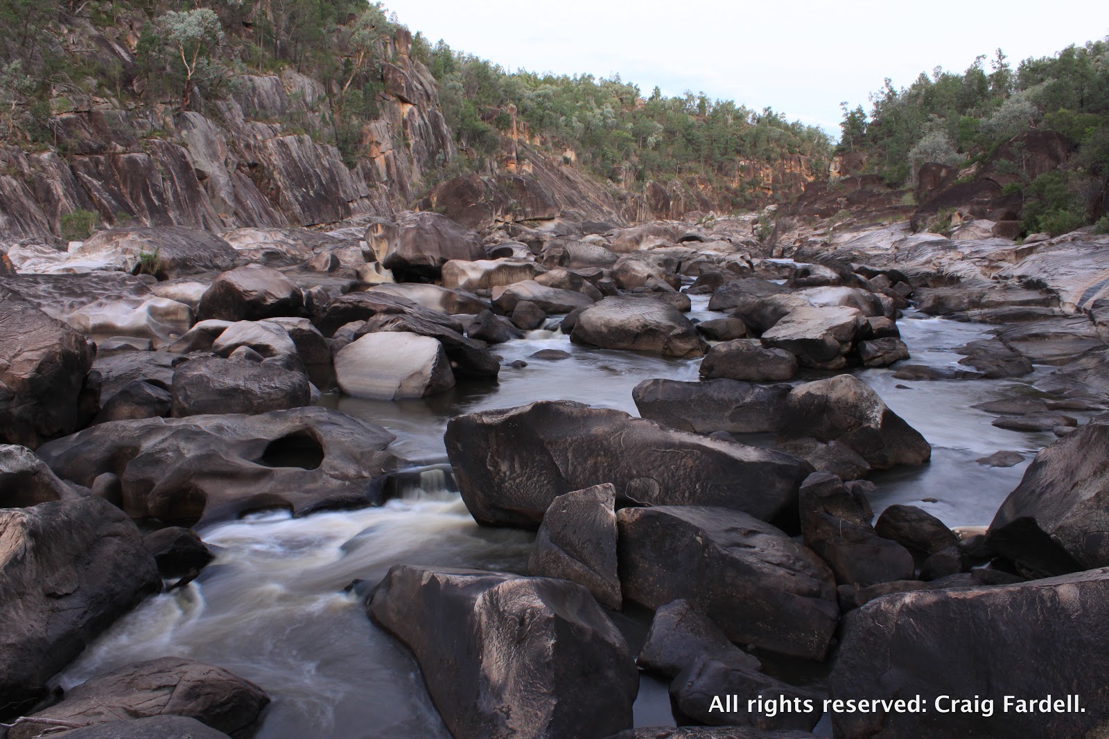
Coombadjha Creek - Washpool National Park

What made us look up? The dimming light perhaps. Something out of the corner of the eye. 

On dusk, the forest filled with fireflies: flitting through the trees, drifting  past us, falling amongst the leaf litter. I could catch them in my hand. As it got darker there were more and more. Behind our campsite, where a footpath cut through the dense rainforest, the fireflies were easy to observe. The majority hovered about 1m above the ground and the effect of so many blinking, moving, playful lights was breathtaking. 

After 20 minutes, they were nearly all gone. Within half an hour - the forest was dark again. 


Saturday 28 September 2013

Granite Tigers and River Dogs - Gibraltar Range & Nymboida NP


Seeking to escape the madness of Christmas one year, preferring instead to immerse ourselves in a deep wilderness, Caz and I set out on a five-day off-track adventure that involved walking across the top of the Gibraltar Range National Park, out past the granite tors of Anvil Rock and Old Man’s Hat, and down a long curving ridge to the Mann River into the remote neighbouring Nymboida National Park. At the river we planned to pull out small inflatable boats, stowed in the bottom of our packs, and paddle 15 kilometres through the rugged Mann River wilderness to its junction with the Nymboida River before continuing another 10 kilometres, around Bridal Veil and New Zealand Falls, eventually drifting through farmland back to our starting point at Jackadgery.

The story of this fantastic adventure appeared in Australia's outdoor adventure magazine, Wild. While the story cannot be viewed online, you can order back issues of Wild magazine by contacting them through their website. The story appeared in issue 128.

In hindsight, this adventure is one of the toughest I have ever done. After the challenging 17-kilometre walking leg we reached the Mann River and I collapsed in an exhausted heap. Caz still managed to find the energy each day to take some spectacular photos so here are a few extra images that did not appear in the magazine at publication. I've also included a few tantalising snippets of the adventure. Hopefully they will inspire you to track down the full story and plan your own adventure in this beautiful and wild part of our landscape. 

Thursday 12 September 2013

Warabah National Park - by the light of a supermoon

It is mid-winter, but hot; sun blasting down and very little shade beneath the sparse cypress pines. Last time here, a year ago, winter was a rude -5 degrees celsius with frost patches lingering until lunchtime. This trip is positively balmy, until we take our shoes off and step into the Namoi River. The water is breathtakingly, painfully cold and knee deep at our crossing point. This is certainly a landscape of extremes.


Thursday 29 August 2013

Taking Lucifer by the thumb - Guy Fawkes River National Park

As we weave our way through tall open forest the Guy Fawkes River valley is visible to our right; its huge, yawning expanse contains thin pockets of morning mist but what I'm looking for down there are the wide riverside flats. They have me dreaming of a lazy afternoon sitting on a clear grassy bank, sipping a warm cup of tea, soaking up sunshine. But, we have only just left the car park and the river is a long way away. As usual, I'm getting ahead of myself.


Wednesday 14 August 2013

Seeking The Inaccessible Gulf - Oxley Wild Rivers National Park


The river is a water green snake sliding across grey rock and it lies far down in the bottom of a steep sided gorge: scree slopes and bare cliffs tower either side. The landscape dwarfs us as we pick our way along the crumbling gorge rim. Down there amongst the boulders, around the next corner, through the deep pools, lies The Inaccessible Gulf. 

And, with a name like that, who wouldn't want to try to get in for a closer look.

Sunday 28 July 2013

Haystack Mountain - Gibraltar Range National Park


Walk north. Leave Boundary Falls by the Gibraltar-Washpool World Heritage Walk. Enjoy the track while it lasts. On the way, detour to Duffer Falls and fill up with sweet granite-stripped water.  Continue on but walk silently. Watch for flame robins. Keep an eye out for a subtle footpad, right on track, at the top of a rise, on a bend.  Disappear into the scrub through hard bending banksia and heath. Head up. Weave footprints and foxtail rush. Create a path between granite boulders. Get scratched. Beware of eyepokers. Emerge from behind New England mallee and find the open space. You are now the needle on Haystack Mountain.

Monday 15 July 2013

New England National Park - walking the cloud forest


We are off track; walking the New England escarpment to Darkie Point. Nests of light settle on the forest floor having broken through a closely woven canopy of Antarctic beech trees which tower above us. Then low cloud streams in. The light freezes mid air, forming thick golden shards that angle against our compass bearing. Ahead, the forest slopes towards the escarpment's cliff line. A prevailing wind drags mist out of the valley below and whips it  up the rock face. The air is so dense with moisture it is caught on leaves and branches and drips, drips, drips as if it were raining.

This is the cloud forest at work: the manifestation of a landscape shaped in such a way, located in such a place, as to draw in and create its own cycle of wild weather that keeps this cool temperate rainforest constantly supplied with water.

Saturday 29 June 2013

The Steamers - Main Range National Park, QLD

It is often difficult being a visitor to new places - you touch the landscape so briefly, you walk the route, see the spectacular views, and are left to only imagine the endless opportunities for exploration. Traveling can sometimes feel more like ticking off the destination rather than immersing oneself in a new environment. However, sitting on the stern of The Steamers in Main Range National Park, Queensland, staring down the length of its spectacular pinnacles and cliffs, I felt that no matter how brief our visit might be it was better than not being there at all.


Monday 17 June 2013

Hat Head National Park - Connors Track

The beauty of our coastline should not be taken for granted. All too often we head inland seeking adventure and remote locations. The coast, however, has a more expansive wildness to offer. Hat Head National Park is a perfect example with its long, undeveloped stretches of coast where dolphins surf endless breaks and vast beaches are broken by rugged forested headlands, where whales pass within a whisper of the rocks below and birds of prey drift by at eye level cruising the on-shore winds.


Sunday 26 May 2013

Apsley Gorge - success or failure?

Sometimes a trip is a success. Sometimes it can be a failure. Often it is difficult to tell the two apart. Our recent foray deep into Apsley Gorge is a case in point. Its sheer crumbling walls tower more than 140m high in points and its sparse water course appears and disappears beneath and around massive boulders and landslips that cover the gorge floor.


Saturday 4 May 2013

Nymboida River - messing about in boats


"Believe me, my young friend, there is NOTHING - absolutely nothing - half so 
much worth doing as simply messing about in boats."

Nymboida River - Platypus Flat to the Cod Hole


Monday 22 April 2013

Kemps Pinnacle - Willi Willi National Park

Why walk when you can drive?

We could all give a dozen good answers to that question but, in the case of our walk to Kemps Pinnacle, it was simply because we didn't know better. Using our topographical map to navigate, in an area little explored by us before, we started walking along Hastings Forest Way before veering onto a closed, old forest road out to Spokes Lookout. From there, map in hand, we continued further along the escarpment past Spokes Mountain where suddenly our forest road disappeared into an overgrown mess of grass and shrubbery.


Our topo showed that the road continued towards Kemps Pinnacle, about two kilometres away, and so we pushed on, waist deep in weeds, scratched to buggery by wild raspberry and rainforest vines following the faint, overgrown impression of the old road. When we burst from the undergrowth onto what we later learned was called Coachwood Road, a white 4WD zipped past our astonished eyes. So, we could have driven.

Sunday 7 April 2013

Dandahra Gorge - Gibraltar Range National Park

The full moon threw a sheet of silver light along the steep sided valley, illuminating the smooth bark of brush box trees lining the boulder strewn creek. We lay on a huge flat rock: no tent, water flowed around us, small bats flitted across the moonlit sky. This fantastic bivvy site was smack bang in the middle of the creek, about 3 metres above the water, with enough room to sleep four or five people. A neatly jammed piece of driftwood provided the only way up or down off the rock. It was a miracle of sorts, being the largest clear, flat area we could find at the end of a long, tricky day of walking. Then the full moon added its magic touch, lighting up the shimmering treetops and creeping its way along the creek bed towards us.


Thursday 21 March 2013

Wild Cattle Creek - Dorrigo National Park


An erratic frontal wind hit us hard, stripping loose leaves from the forest canopy and throwing them about like confetti. The weak light in the rainforest dimmed to almost darkness – it was only 3.30pm. I walked in circles at a manic pace thinking we might have time to pitch the tent before the storm hit. But, it was far too late. The noise in the treetops left no doubt that we were going to get caught out. Around us we could make out the black sillohuettes of gnarled beech trees: a fine grey mist drifted through first and then thunderous white streaks of rain began hammering down. Within 3 minutes every single thing was totally saturated. We huddled together, rain jackets on, packs at our feet, and a one metre square piece of tarp over our heads, water pouring off it so fast we could have filled our drink bottles in a second. The forest canopy swayed wildly above our heads and leaf litter washed away in rafts on the slope around us, exposing the rainforest topsoil and tree roots at our feet. It was a rude interruption to what had otherwise proven to be an idyllic weekend adventure. 

Saturday 2 March 2013

Kwiambal National Park

Searching the grooves and hollows of the sculpted rocky river bank, big dumps of flood debris yielded shapely logs tumbled and worn smooth from the motion of water. Unfortunately, we needed something smaller than logs. One pile yielded a few possible choices but, we were after spoon sized pieces of clean, smooth timber. We were hungry and  I'd left the cutlery at home, 400 km away.


Saturday 23 February 2013

Smoky Cape Lighthouse - Hat Head National Park


I initially wanted to write this blog like a "track notes" with detailed directions for a day walk around the forest and coast near Smoky Cape Lighthouse, but the notes I had were years old. So, back we went, two weekends ago; spending a day roaming around the tracks and coastline north of the lighthouse. Just as well. My old track notes were nearly useless. It's amazing how nature keeps on being nature: growing, changing, moving, evolving.


Saturday 9 February 2013

Rosewood River in Dorrigo National Park cures cabin fever


A rainy weekend to end January 2013 seemed like a good time to share a trip from a couple of years ago that involved going out in the rain and the wind in the name of wilderness and avoiding cabin fever. As I write this (last weekend), a cyclone from up north is rattling the windows and whistling around the verandah ends and it’s bucketing down outside. It is reminiscent of 2010 when we had an exceptionally wet spring and summer and autumn on the North Coast of NSW. Most overused phrase of the season was ‘east coast low’ and after weeks of intermittent showers and one extended stretch of 10 days of solid rain there was nothing for it but to drag out the Gortex jackets and waterproof overpants and go for it. Forecasts at the time showed no sign of the rain letting up and Caz had come down with a murderous case of cabin fever. And when it's raining, what better place to go than the rainforest. 


Wednesday 23 January 2013

South Bald Rock - Girraween National Park

Dark grey rocks emerged in vague detail, one angular boulder jutting centre stage between the rounded curves of enormous granite slabs. Glimpsed through a distorting veil of thick fog, the rocks were streaked with wet and the scenery felt like a mystery to be solved. Some trips are all about mood.


Saturday 12 January 2013

2012 Campsites: the best of the best


The tent and the campsite is a home away from home, even if just for one night. It’s nice when a campsite comes up with the goods – million dollar views or beautiful forest, soft ground, water, the right feng shui. That’s not always possible. Sometimes we are left searching out a patch of clear ground between too many trees or pitching on a tiny edge of river bed too close for comfort to the rising water.
However, more often than not, nature comes up with the goods and we have had some truly stunning campsites. So, with a new year now in swing and new adventures ahead of us we thought we’d quickly share some of our best campsites of 2012.