
There is meant to be a mountain above us. I keep looking up in hope. I see nothing but a ceiling of cloud - the sky, overcast and low. It seems, if I stood on tippy toes I could touch it. As we follow the track towards the base of this invisible peak, it is tempting to turn around. I am wondering, what fun could we possibly have on a mountain in grey, wet soup like this? We keep walking, despite. There is, after all, a mountain above us, whether we can see it or not.
The track in is certainly scenic enough. The high country forest in this part of the world is some of the most beautiful I have encountered. An open woodland of tall snow gums stretches away in all directions (E. pauciflora, which in Tasmania the common name here is cabbage gum hence, it pays to reference the latin). Their mottled grey and white bark is an elegant palette that matches the soft greens and blues of the tree’s foliage. There is a low, sparse understorey of shrubs. The Mountain Guitar plant (Lomatia polymorpha) is flowering profusely in big creamy bunches. Occasionally there is a taller shrub, Mountain Currant (Coprosma nitida) loaded with bright orange berries that look ready to burst with juice. One of the leptospermums is also in full bloom and its fragrance is intensely sweet, its white flowers densely clustered. As we continue walking, the track climbs out of the forest and emerges onto an open button-grass hill. The grass is a vast golden carpet. Bobble-headed flower spikes shoot from every clump and they are also in bloom. Creamy flowerheads sway gently in the light breeze.

After nearly an hour and a half of walking we reach the end of the old 4WD track and there is a walkers log book. It marks the start of the foot track that leads to the summit of our invisible mountain. The track narrows and heads directly, and steeply, upwards. The cloud has not moved. It is still tempting to turn around. And still, we keep walking.
The weather forecast has promised a relatively good day for these high, volatile mountains. I put my trust in the numbers - 0% chance of rain, 9km/hr winds - then look up at the slope ahead and see the base of the clouds. It shouldn’t be long and we will lose all visibility.


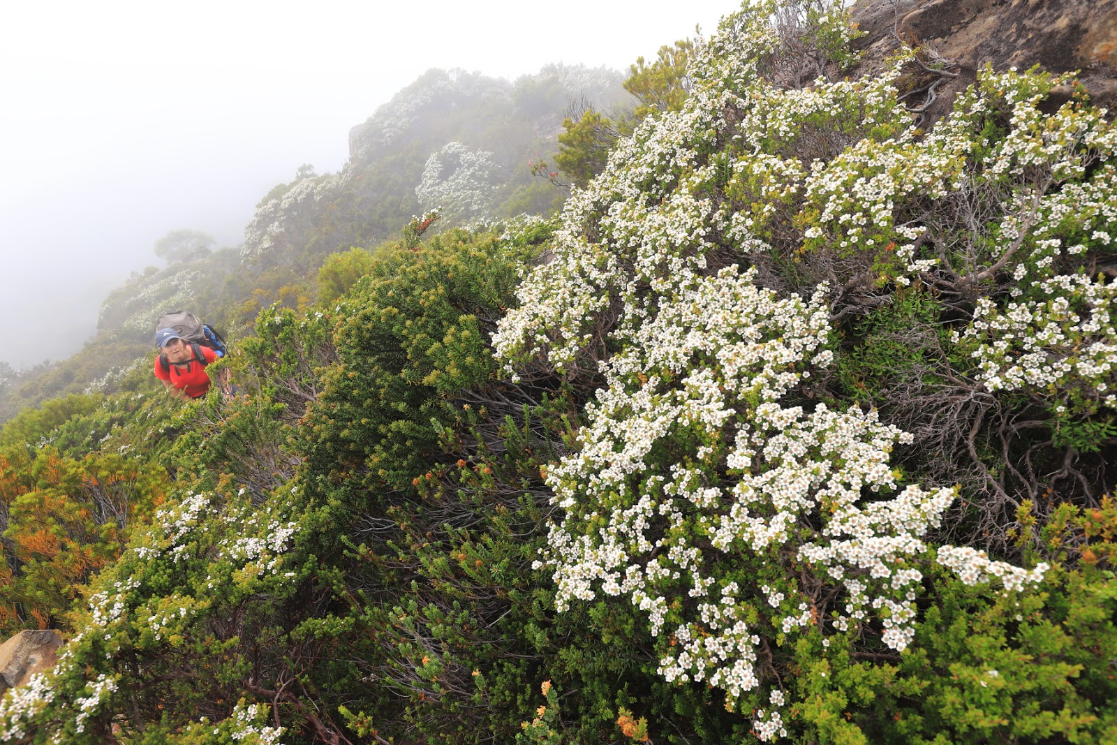
And yet, as we climb it seems like we will never reach the ceiling above. The track winds through stands of varnished gums - the world’s smallest eucalypt and one of the most cold tolerant. It grows to 1000m above sea level. At times, on mountaintops, it is so small it is easily mistaken for an alpine shrub.
About three quarters of the way up, I look up and realise I can see straight though the clouds above. I don’t want to say anything, I don’t want to jinx things; or get excited, but up ahead, through the cloud, that is blue sky. By the time we reach the summit, 40 minutes from the start of the foot track, the last of the cloud is drifting eastwards and we have walked into a porcelain blue sky with immense views in all directions. We are atop another of Tasmania’s monarch mountains - Mt King William I.

We learnt about Mt King William from a walker we met at Frenchmans Cap. The Cap is known as the Monarch of Tasmania’s west. Mt King William is not nearly so regal a peak but it at least bears a monarch's actual name. We had been told to check it out. It was his favourite overnight walk out of Hobart. He said you usually have the mountain to yourself, as it is little known and not hugely popular. And, he said, once you are up there is plenty of scope for exploring the small plateau behind the peak.

On all counts, he is right. We have the mountain to ourselves. We sit on the peak and soak up the views. We wander around - there is a helipad up here, three communication towers, and a shed. There is also an old concrete slab. Someone has used it for a camping platform with rocks for tie downs. We use it for lunch and below us, on a small terrace of rocks and vegetation is an echidna foraging under small shrubs and clambering over the uneven terrain.
The views eastwards are brilliant. Long ranges of forest clad mountains and to the north-east the distinctive peaks of Cradle Mountain-Lake St Clair National Park.


Perhaps the most astounding thing though is the March flies. We posted a short video of this on our Facebook page. It is hard to describe the intensity of their presence. They are in swarm proportions, feeding mainly on the flowering tea tree up here. Also possibly feeding on the flowering orites and various other shrubs. It is mid-summer and the plateau and peaks are a patchwork of colour - everything that can, is flowering: snow gentians, daisies, mountain rocket, silky minnon, plum pine, cushion plants, lemon boronia.
After lunch we wander down on to the plateau behind Mt King William I and find a campsite. The flies follow, or there are just more of them, everywhere, on every shrub. We pitch the tent. I spend the afternoon relaxing with the swarm, while Caz takes a quick jaunt up nearby Milligan’s Peak. I cannot describe the din of the March flies as they grow frantic with panic and purpose once caught between the fly and inner of the tent.

When Caz returns we spend another hour or so exploring the plateau, heading east to a surprising cliff line. From here we can see the fabulous dolerite face of Mt King William I, hidden on the climb up by the uncertain sky. Now we get a sense of what a grand peak it is. But the cliff line we are standing on is also surprisingly impressive. Again, it is made of fluted dolerite columns but what is obvious is how the ground has simply toppled forward to expose the cliff. In a sheer line, the land has collapsed into a pile of massive boulders which we see 30m below. What is more obvious, is the plateau is getting ready to do it again. Just 2-3 metres back from the cliff edge is another long fault line. In parts is it already nearly a metre wide. I drop a rock down the gap and it falls into the black abyss and takes a second or two before it hits anything. I hear it continue bouncing further and further into what I realise is a frighteningly deep crack. I decide to jump back onto the landward side of the fault line and watch as Caz scampers along the cliff edge taking pictures. Any minute now...well, one day, that fault will open wide enough and gravity will pull this cliff to the ground.
Just behind the crack is a nice little peak of rocks. We climb up and admire the view of the King William Range as it runs southwards. This is the starting point for several challenging, multi-day walks. You can continue out to King William II and King William III and return the same way, or drop down onto Lake King William and follow it back in a loop. The ultimate adventure is the epic three ranges crossing - running King William Range, across to the Prince of Wales Range and onto the Hamilton Range, emerging at the Gordon Dam many days and kilometres away.


We are here for a more immersive, laid back experience and so after our little wander, Caz and I gather water from one of the small tarns and head back to our tent. By 8pm a few clouds are reappearing and slowly, slowly, dropping lower and lower. Milligan’s Peak behind us, disappears. Before turning in for the night, we take a compass bearing for the communication towers on Mount King William, just in case.
When we wake in the morning, the sky has inverted itself. Our peaks are in the sunshine and the valleys and plains beneath us are covered in a thick blanket of fog. The fog pushes up the eastern face of the mountain and every now and then it smothers us and the mountains. Then it clears again. Then closes around us once more. When we retrace our steps to the summit of King William I we are treated to a fog bow. Fogbows – sometimes called white rainbows, cloudbows or ghost rainbows – are made much the same way as rainbows. Rainbows happen when the air is filled with raindrops, and you always see a rainbow in the direction opposite the sun. Fogbows are much the same, always opposite the sun, but fogbows are caused by the small droplets inside a fog or cloud rather than larger raindrops. Because the water droplets in fog are so small, fogbows have only weak colours or are colourless.

We linger with the fog and its bow before beginning a weirdly inverse experience. In an exact reverse of our ascent up Mount King William we walk down out of a sunny day and into a grey overcast valley. As we descend, the mountain disappears. Behind us, the big dolerite cliffs of its southern face are once again invisible. As we head back along the access track to our car, the cloud feels low enough to touch. Another walker is coming towards us. We stop for a quick chat and he looks up at the low ceiling of cloud and says he is tempted to turn around. I can see him wondering, what fun could he possibly have on a mountain on a grey, soupy day like this?

All images and words on this site are copyright of Craig Fardell and Christina Armstrong. It is illegal to sell, copy, or distribute images and text without permission. We thank you for your help in respecting the copyright of our work.
I enjoyed your interesting account and your beautiful photos. Thank you. Those march flies were still there yesterday when I went up there!!
ReplyDeleteThanks for visiting out little blog Marian and for the nice comments. Those march flies were certainly an intense experience for us. Hope you still enjoyed the fabulous views from the summit!
DeleteCan you get up and back in a day?
ReplyDeleteHi Trace, yes, you definitely can do this as a day walk.
Delete